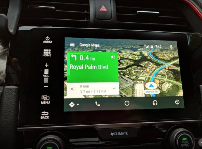
While Google Maps’ navigation is already easy enough to follow, some people still prefer to use the satellite view version with its real-time imagery. It’s been available on the mobile version for some years now, but one platform that has not been included was Android Auto. But now finally they have decided that those who are driving would benefit from having the option to view their map in satellite mode. So if you have the in-car infotainment platform, update it to the latest version to see this new viewing mode.
The map view on Android Auto is mostly the same as in your mobile device, with the solid background and roads, building outlines, and a few landscape features. Since it’s simple and minimalist, it’s pretty easy to read and follow. The satellite view meanwhile uses images from, well, satellites, so you get a more detailed view of your surroundings This is important when you’re not familiar with a place and you would need to find some landmarks when you’re navigating.
The disadvantage of using the satellite view is that it will definitely consume more data. As you continue your drive, Google downloads the high-resolution images that it will need, even though 3D buildings are not yet included for now. If it’s a long drive, then don’t be surprised if your data allocation gets eaten up with this mode. So if you need to save up on your data, make do with the normal map view.
You can update your Android Auto app if you want to try out the satellite view. Just go to your settings to check and then switch to the mode that you prefer.
VIA: Android Police, Google+


