Google Maps’ Street View has been a veritable source of information, direction, and even entertainment for users who want to see a more “real life” view of the places they’re going to or want to explore. Of course, it’s been available on Android for some years now but for some reason, it hasn’t been as integrated into the mobile version as it is on the desktop. Finally, it’s all changing now as we now have a Street View layer option in Google Maps.
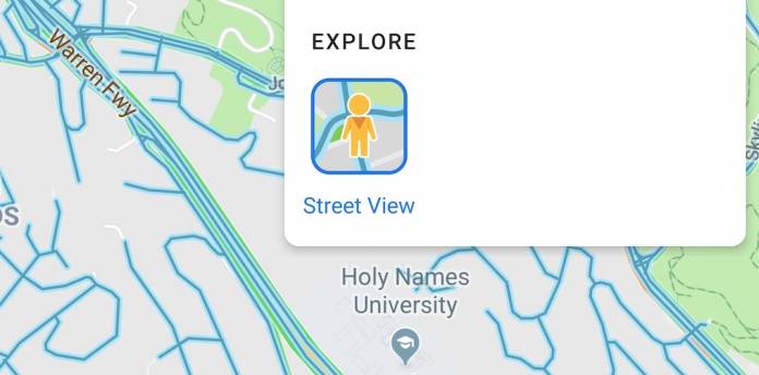
According to Android Police, users have spotted this new layer in the different map types options when looking at a certain location on Google Maps. Tapping on that symbol just underneath the search bar will show you different options like map types (default, satellite, terrain), map details (transit, traffic, bicycling), and now under explore, you’ll see Street View. You’ll see a layer of blue lines that you can tap on.
The bright blue lines, similar to what you see on the desktop, will show you the streets which the Street View cars have already explored. Just tap where you want to go or which you want to view and you’ll be brought to the Street View whenever available. While you can always just go to the dedicated Street View app, having it integrated into Google Maps may be more useful for a lot of users.
While it’s been spotted by a lot of users already, there is no news yet if the rollout is complete. Knowing Google, it’s probably a gradual server-side one so if you’re not seeing it yet, don’t panic and just wait for it to appear on your Maps.
Google Maps is proving to be one of the most useful ones from Google’s stable of apps. We’ve seen a lot of recent updates that has turned it into more than just a navigation app. But it’s also pretty nice to know that they are still improving on its most basic function even as they add new business discovery and travel tools.


