


If it’s been your lifelong dream to travel to space but have yet to start your astronaut training (or you probably never will), the next best thing you can do is to look at photos and videos that they post. Well Google Maps is giving you a better alternative as you can now explore the International Space Station through Street View. You can take a look at the various sections in the 15 connected modules that are floating 250 miles above Earth and dream of the day when it would be you up there.
The usual process when capturing images for Street View is to use Google’s 360-degree camera car. But of course they couldn’t do that here. Even sending cameras up to the ISS would take a ton of certifications and permissions. So what they did was get the services of someone who was already up there. Thomas Pesquet is a French astronaut from the European Space Agency (ESA) who was on a six-month stint at the station.
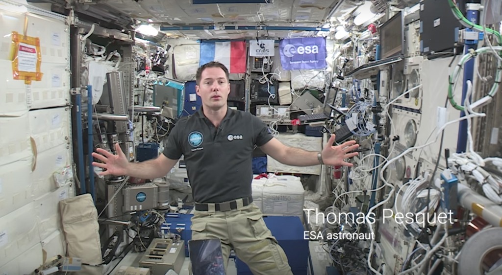
The Street View team also worked with NASA and the Marshall Space Flight Center to come up with a method to collect images using the DSLR cameras and other equipment that are already aboard the station. Oh and of course Pesquet had to do it in zero-gravity conditions and also while doing his real job aboard there. He sent the images to Earth and the team then stitched them together to create a panoramic 360 degree view of the various modules in the ISS.
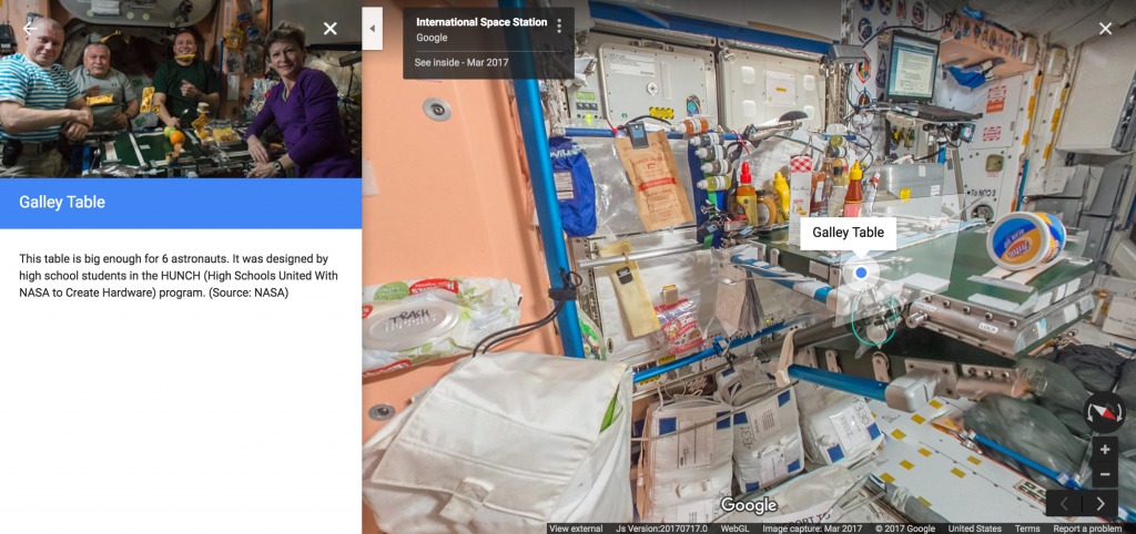
You can now view the entire collection on Google Maps. And if you’d like to read about how they were able to do it, Pesquet himself wrote a blog post about it. Someday soon, we might get a Street View of the moon or other planets right?
SOURCE: Google


“Ground-breaking” it definitely is not. Pretty cool, though…
https://www.google.com/streetview/#international-space-station/
Yea, it’s mind boggling how they don’t link to the link that the story is about, but you can follow a link in the source link to find it.