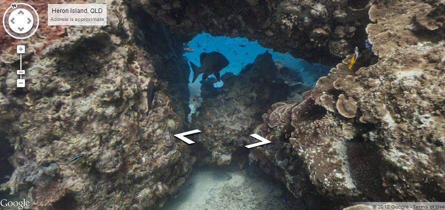
Apple Maps may be trying to drive people through buildings and down roads that haven’t existed in years, but meanwhile, Google has been busy adding underwater locations to its own Maps offerings. Starting today, Google Maps users will be able to get a look at select underwater locations such as the Great Barrier Reef through Street View. How’s that for a cool addition?
At first, adding these underwater locations may seem rather pointless, awesomeness aside. However, the addition of underwater locations does have some real-world applications, as marine biologists and scuba divers could use this new functionality to pick out points of interest. Along with the Great Barrier Reef, Google Maps will also allow users to get an up-close glimpse of some ancient coral off the coast of Apo Island in the Philippines, Oahu’s Hanauma Bay, and the coral reef that has taken up residence in Maui’s Molokini crater.
Obviously, this is a pretty big undertaking, so Google had to call in a bit of help to get these underwater locations into Google Maps. These new additions are the result of a team up between Google and The Catlin Seaview Survey, which is a major scientific study of Earth’s coral reefs. The Catlin Seaview Survey used their SVII underwater camera to take the pictures that are now featured in Google Maps.
Google has been increasing its Street View offerings a lot lately, recently giving Google Maps users the ability to explore portions of the Amazon rainforest. Even if you’ll never make it to the Great Barrier Reef or Hawaii in real life, these new locations in Google Maps offer a pretty great way to get up close and personal with some of Earth’s most diverse collections of marine life. Let’s hope that Google keeps adding more underwater locations from here on out, because we can’t get enough.
[via Google Maps Blog]


Useful for when Apple maps drives you into the ocean
HAHA that is the funniest thing I’ve heard all week! Cheers!