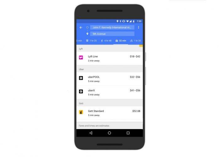
Over the past few years, ride sharing and carpooling have become buzzwords and actual services availed by a growing number of people, due to continuous traffic congestion, occasionally increasing gas prices and car maintenance costs, and various other reasons. Google Maps started adding these services a few months ago as an alternative option to walking, driving, or commuting. Now they’re adding two more ride sharing options to choose from, (in case you didn’t feel like taking an Uber or its myriad of services): Lyft and Gett.
Last March, Google Maps actually introduced another tab in the app when searching for ways to get to your destination. Next to the walking, driving, and transit options, you now had a ride sharing tab and it will show you fare estimates and estimated time of arrival of the service. But unless you live in other areas like Brazil (99Taxis), India (Ola Cabs), the UK (Hailo), Germany or Spain (My Taxi), then your only option there was Uber (and its various services like UberPool, UberBlack, etc).
But now you’ll also be able to get options from Lyft and Gett (but only if you’re in New York for the latter) so you can better compare it with the price and availability of the rides. They will also be displaying the different types of services from each. For example, Lyft also has Lyft Line, aside from its main one. Lyft will be showing across all the US states where it’s available, but Gett, as we said, is only in New York for now.
This brings ridesharing options in Google Maps to a total of 9 different partners across 60 countries. It’s a pretty convenient way of seeing all your options without having to open up different apps. Let’s see if more will be added in the future.
SOURCE: Google Maps


