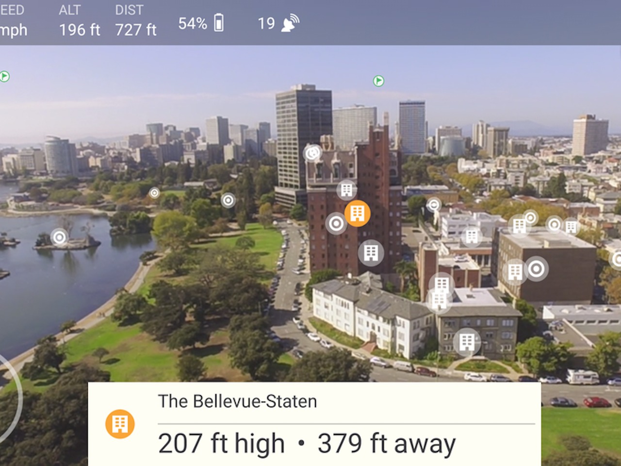
We have a handful of navigation apps for cars like Waze, HERE, Google Maps. But what about for drones? Okay, they aren’t as ubiquitous as cars of course, but wouldn’t it be cool if those who have drones will be able to use an app to navigation those little fliers? The creators of Hivemapper sure thought so, and now they are launching a beta app and what’s more, they were able to get $3M in seed funding from investors led by Spark Capital and Google Ventures.
Basically it wants to become for drones what Waze is for cars. Using the app on your smartphone, you’ll be able to see what your drone is seeing as it flies. You will also be able to see some pop up items like building distances, the altitude that it is currently flying at, as well as points of interests that it is flying over. And to make sure that you won’t be flying in a no fly zone, the app also uses data from the FCC and FAA.
Hivemapper has basically already created detailed data for footprints of over 20 million buildings, the height of 10 million buildings, tens of thousands of no fly zones, and around 15 million points of interest. This is according to Mo Kofyman, the General Partner of Sparks Capital and a new Hivermapper board member.
Of course these figures only cover the US. Some other features like 5,000 waypoints and over 500 launch points refer to the SF Bay Area. If they want to be as big as Waze, they will probably go the crowd-sourcing route as well. You can download the Hivermapper beta version for free from the Google Play Store. That is of course, if you have a drone.
https://www.youtube.com/watch?v=zLyK6Bsc3zQ
SOURCE: Spark Capital


